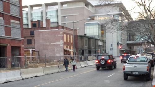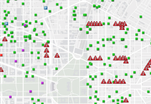
DC has created a map that shows where it has issued permits to block sidewalks and bike lanes for construction projects, and soon, the city will begin releasing more detailed data about where vehicle collisions have happened. Both will tell us more about where in the city pedestrians and bicyclists are at risk, which will make it easier to make those areas safer.
The map went up in August and is updated daily based on public space permits that DDOT issues.
On the map, the green squares are where a utility company has a permit to block the sidewalk or bike lane, and the yellow triangles are where one has applied for a permit. The red triangles represent permits for DDOT contractors to work in the right of way, taking away parking for a temporary span of time. Orange squares mean there’s a permit for a block party, purple squares are for mobile cranes, and red squares are for special events.
Jonathan Rogers, a policy analyst who reports to DDOT director Leif Dormsjo, said, “Obviously, DDOT can’t be everywhere inspecting work zones, so to the extent residents are checking the public traffic control plan… we can work together make sure developers are keeping the streets and sidewalks safe.”
We’ll soon know more about car crashes around the District, too
DDOT will also soon begin publishing monthly reports with information about vehicle collisions, including the ward, block or intersection, the type of vehicle involved, the Police Service Area where the crash occured, the number of people killed or injured, and why it happened.
Some of this data, like the date and time of crashes and the geographic X/Y coordinates for the location, is available now in an open format, but it’s much more sparse than what’s on the way.
“This open data is a matter of transparency,” Rogers said. “People have a right to know where traffic injuries and fatalities are occurring in their city. If residents do nothing more than discover the safety trends for their own neighborhood, that is part of good, open governance.”
Rogers also points to how the data can be crunched in a variety of ways that DDOT may not have thought of.
“We want to tap into the expertise among the many data scientists out there, the civic hackers, coders, etc. and see what kind of correlations they may discover. Perhaps they can identify locations in need of urgent improvements that DDOT may not have detected.”
Before DDOT starts issuing those reports, however, it has to be sure that they do it in a way that doesn’t disclose personal information about victims that the Health Insurance Portability and Accountability Act (HIPAA) doesn’t allow.
“We’ll continue to publish the crash and violation data in the open data format in the meantime,” said Rogers.

